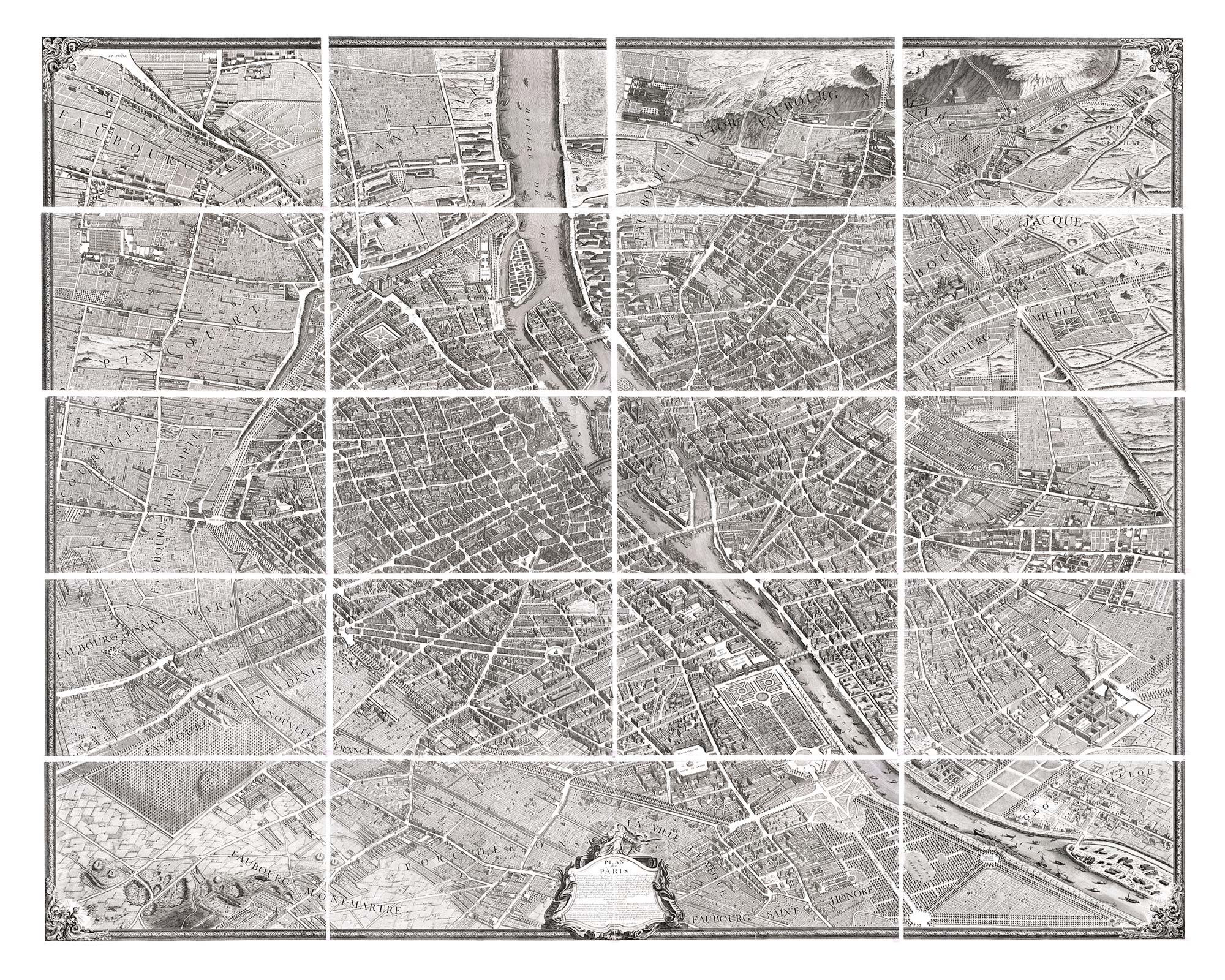
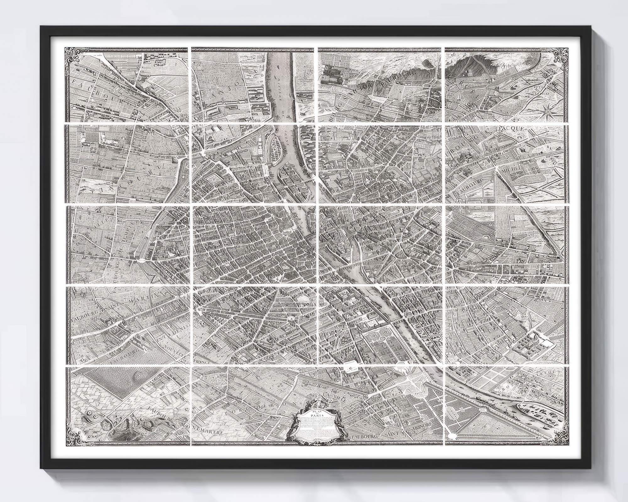
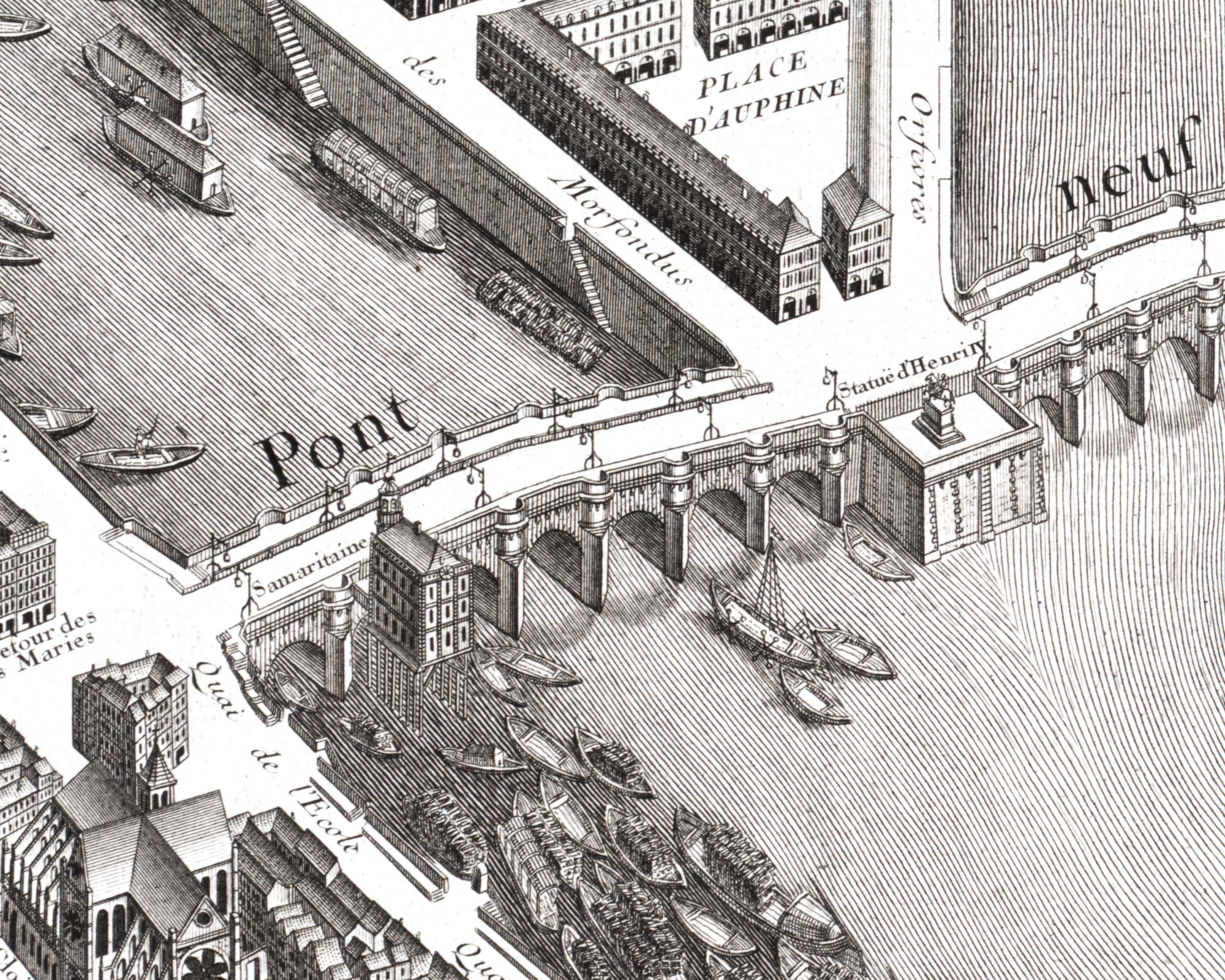
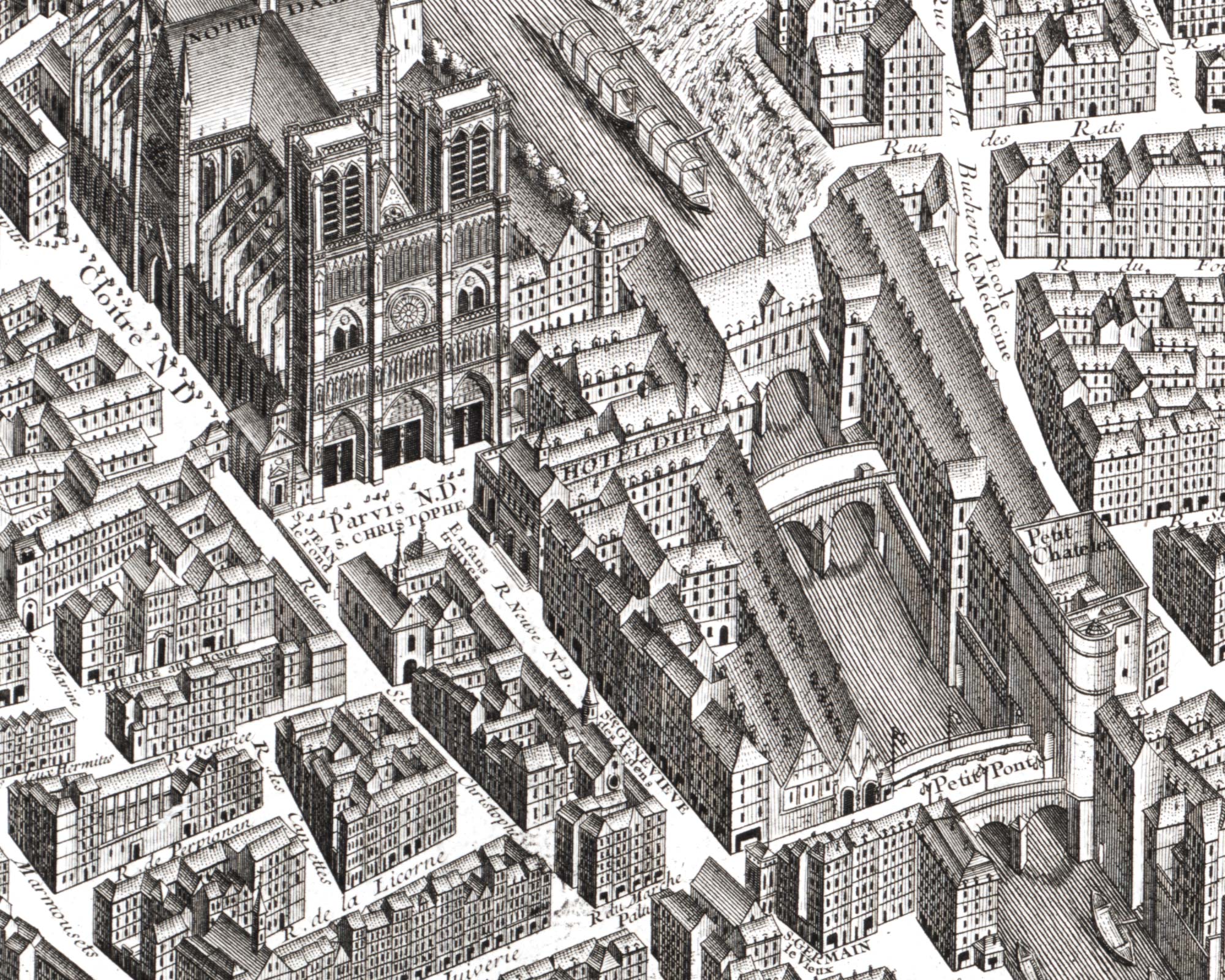
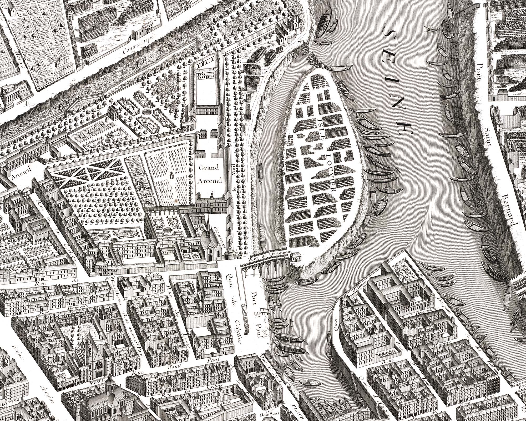
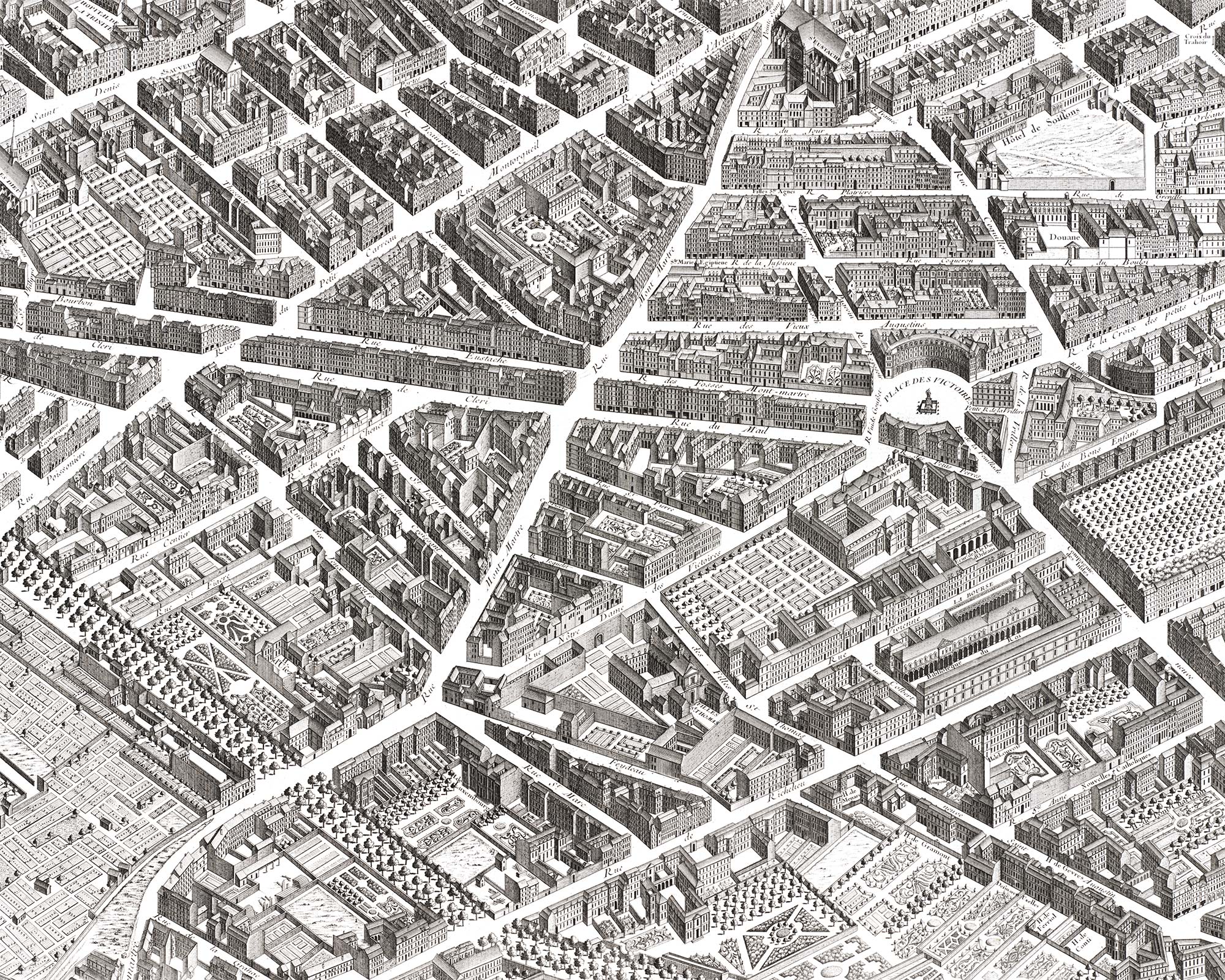
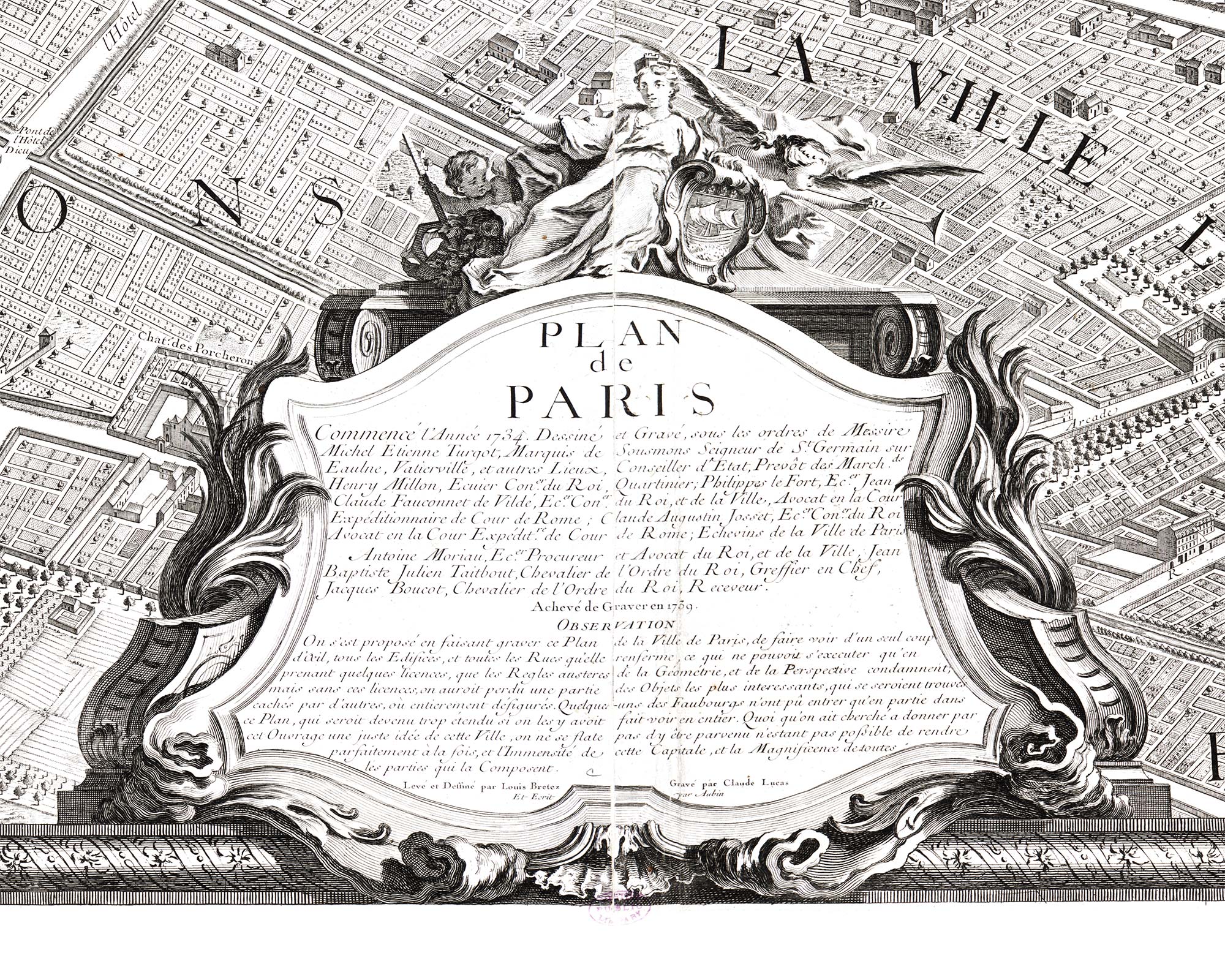
Attention! Lovers and admires of old maps, THIS is a treat! “Turgot Map of Paris – print edition” presents a digitally restored version of the iconic Turgot Map of Paris, an exquisite cartographic masterpiece from the 18th century, meticulously crafted between 1735 and 1739 by Louis Bretez. The map offers a panoramic view of Paris, capturing the streets, buildings, and landmarks of Paris with unparalleled detail of the time. The map offers a mesmerizing glimpse into the city’s past. The juxtaposition of rich architectural detail and the absence of life in the streets is as well striking. While the streets remain empty, the Seine River teems with activity, where workers and fishermen going about their daily lives. After a while you get captivated by the intricate network of void lines and shapes. When viewed from a slight distance, they coalesce into a grand, abstract representation of the city about 300 years back in time.
Through the process of digital restoring and reimagining the Turgot Map, I not only preserve its historical significance but also pay homage to the vision and technical skill of its creators.
The original etching consists of 20 separate sheets, each approximately 85x55cm in size. Put together (in four columns and five rows), the entire work is approximately 340x275cm in size.


